Hospitable Burma 

Needless to say, we have had to rely on the kindness of strangers a fair amount on our trip and the generosity and willingness we have experienced has been pretty humbling in all four countries we have visited so far.

We have been pursued a kilometre down the road in Thailand just so our chaser could present a gift of fresh fruit; another guy in Vietnam took 30 minutes out of his working day to lead us back to the correct road after we got lost and whenever we have needed assistance with the bike swarms of people have always been eager to help us get back on the road.

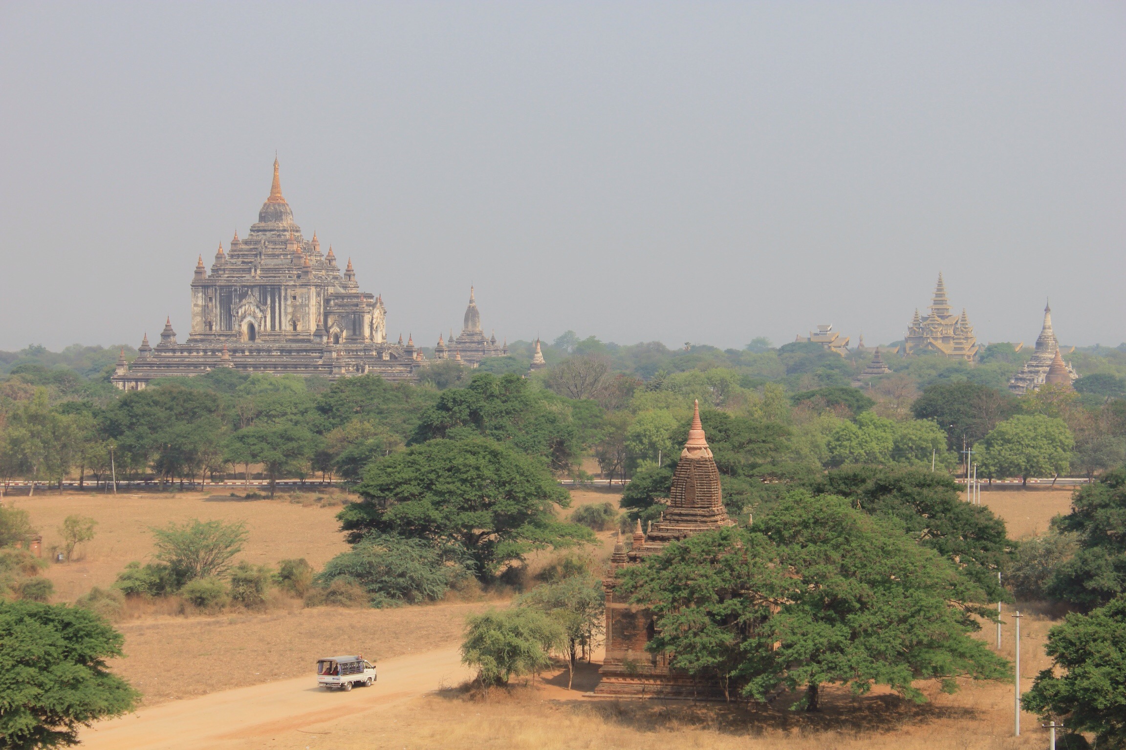
Nowhere is quite like Myanmar for this giving spirit. The past three days have involved us hitching 150km via 3 pickup trucks, taking refuge in a local monastery and being offered hospitality by a wonderful family in a remote village. 

image

After leaving mum and dad in Bagan before they headed back to Yangon for their flight home we ended up hitching the majority of the way to Mandalay just 30km outside of Bagan. We started to hear a crunching and thought it sounded like the bearings in the bottom bracket so decided it was safer to get to a bike shop ASAP. 

Our first ride was a covered truck which already had around 12 teenage boys in it but somehow we managed to fit Paddy and the bike (still loaded) in there too. I got front seat. 🙂
image

The second ride was with two guys in a pickup truck who drove 15km out of their way to drop us off. 
We then cycled out of town before hailing down our third lift, another pickup truck which was carrying a family. There turned out to be a slight communication breakdown on this last lift… 

It turned out that this truck made quite a spectacular detour south to pick up a large collection of sugar cane from a village which wasn’t even on our map. By the time the truck had been loaded and we had worked out that they were planning to tie the tandem and us (along with the family!) to the top it was 6pm. 
  
We managed to communicate that perhaps it was easier for everyone if we stayed the night in the village and set off early by bike the next morning. A young 25 year old called Ye Naing, who is studying at a local university, arrived and took Paddy to meet the village head and we were given permission to stay with the monks in the local monastery. 

Everyone was so friendly; we were taken to the river so we could swim and wash, fed a huge meal and then treated to an excursion in the head Monk’s car to visit the Werawsana temple which is the first pagoda made entirely from jade. It’s a popular temple to visit at night, spectacularly lit up with peaceful gardens encircling the base.

  
Here we are with Ye Naing, his uncle and some boys who came with us from the monastery. 

image

We slept well and after breakfast Ye Naing arrives and tells us he has arranged a lift for us to U Bein Bridge, the famous teak bridge in Amarapura, just outside Mandalay. He says we should visit the bridge as it is a good thing to see and then we can perhaps cycle the 10km into the centre to find the bike shop. We can’t argue with this plan but can’t help feeling that they are all going to so much trouble for us. Ye Naing simply tells us they are very happy to help us.

  
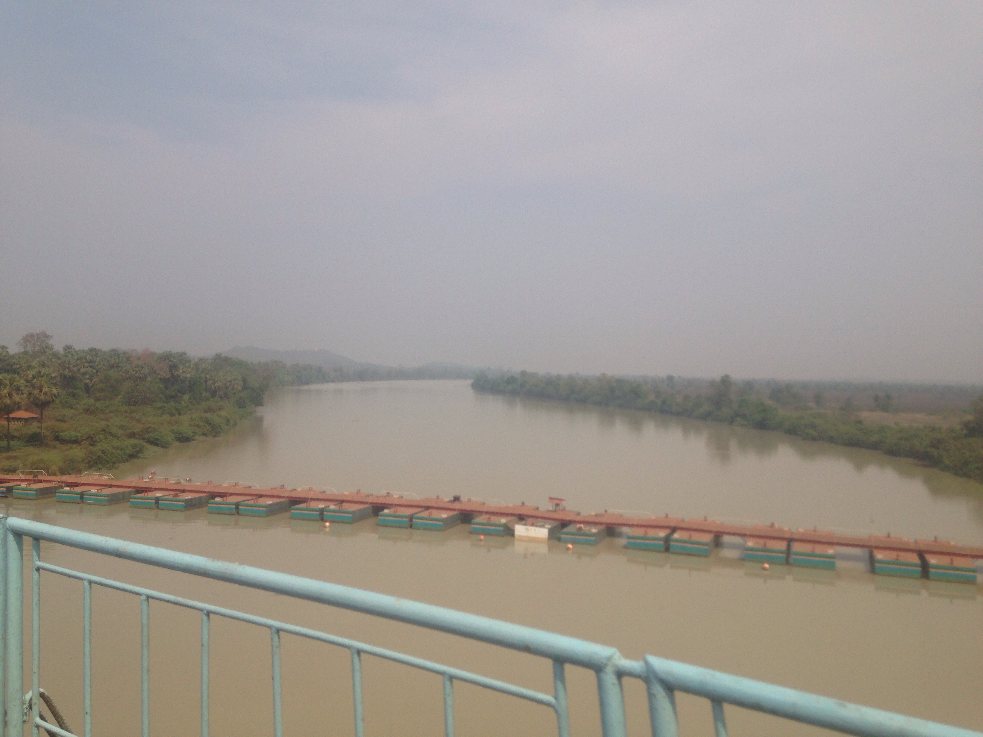
U Bein is pretty cool, and a great place for us to sit, enjoy the peaceful views and morning sunshine while thinking about the generosity we have just experienced.


Young female nuns with a herd of cattle swimming across below
 
We take the bike to a workshop who give the bike a good service. Turns out the bearings are fine and the crunching was the back chain which just needed a thorough clean…! Onto Pyin Oo Lwin!


Bagan and Mandalay with the Sheens

Like all the literature says, Mandalay is rather a disappointment. We had one day to explore some of what the city had to offer before taking the river boat downstream to Bagan. After our 4 day cycle to reach here we were very happy to take a backseat in terms of the ‘itinerary planning’ and so mum and dad hired us a day taxi (there are no tuk tuks in Mandalay!) and we spent the day exploring some of the main temples and monasteries.

We also indulged in our first proper western meal which was, to tell you the truth, very very enjoyable!
image

Occasionally you need that taste of home, even if what your eating is a poor imitation of home comfort food.


We also enjoyed a great sunset over the river and polished off the evening with a traditional puppet show which was very interesting despite some of the puppets lacking a little ‘finesse’. The erratic half flying horse sequence was probably the best… 🙂

The next day we spent the whole day on the boat down to Bagan. Expensive at $40 a ticket (they charged $5 extra for the bike). Mind the baggage handlers at the dock area who will insist on carrying your bags down the steps. At first they perceive to be part of the boat team but it soon becomes clear that they are a very well organised scam, placing official looking tags on your bags which don’t really mean anything and then demanding 1000k from each person.

The trip was a very pleasant way to travel though and we all enjoyed relaxing on the boat and taking in the scenery. We teach mum and dad Yahtzee and have a good few games along with partner whist. Mum manages to beat everyone in both games despite having to double check the rules at every go!

We arrive at the north port in Bagan at 6ish. All the major roads into Bagan town have checkpoint stations where tourists are required to pay a $22 admission fee for the site. Normally we wouldn’t mind paying this fee but currently in Burma most of this money goes straight to the government with very little of it actually going to the upkeep of the actual archaeological site. We would prefer to donate to each temple as we visit, and hand out cash individuals rather than propping up the corrupt system (plus we’re trying to save some pennies!).

If you are arriving by taxi, bus or other kind of transfer it’s difficult to avoid paying the fee. Being on the bike, we were able to cycle the back way through the shanty towns on the edge of the city but if you were wiling to carry your bags you could also walk it. It was hard going on the bike sometimes but very doable and there’s a good article on the wiki travel web page on how to skirt round the various ticket booths depending on which direction you are arriving from. You only really get asked for your tickets at the temples you can climb (8 in total).

The next 3 days were spent exploring the 4000 (there used to be twice that before the 1975 earthquake!) temple sites which litter the flat planes of Bagan. We enjoyed tailing mum and dad on our tandem as they trotted around on their horse (called War Horse) and cart. 

War Horse taking mum and dad round

If you cycle, take care on the very sandy roads!

Some pictures to end…


Paddy and mum discussing the 11th Century carvings


Exploring inside


Sunset view


3 Day Ride: Pindaya – Mandalay (via Ywengan and the ‘back way’ from Kyaukse) / 224km

Day 1: Pindaya – Ywengan

Distance: 80km (19th March 2016)

Road: up and down all day, paved but bumpy road; had to go 20km south from Pindaya first before you head northwest to Ywengan.

There is a steady climb out of Pindaya and then you get to enjoy some lovely rolling countryside. 8km in, our chain gets really jammed and we have to take an hour to tease it out from inbetween the derailer and kick stand… The cycle otherwise was pretty uneventful although there was a fair amount of climbing involved.

Ywengan is a small town (make your way to the centre) but there is one simple guesthouse (Khansan Guesthouse) for USD 10 – this is pricey for the room you get with a cold water bath and toilet outside although we did re-fill all our water bottles for free from his water dispenser. There are a couple of OK restaurants and a decent cafe half way up the hill – great for breakfast.

Day 2: Ywengan – wild camping 10km NW from Kyaukse (20th March 2016)

Distance: 90k by mostly downhill

Road: Paved – pretty darn good for Myanmar, especially considering how quiet and unused the road is – great ride down with spectacular views!

Mostly Up with a bit of down for the first 10k. You pass some sleepy villages where we stopped for a coffee and cake break and the scenery is great.

We pass a cool temple complex complete with four huge Buddha statues looking out across the valley.

  
The road is lined with white cherry blossom, dusted pink in the centre of each flower.

  Here I am just after we started the long decent! 

The road is narrow but in good nick with very little traffic. It zig-zags down in front of you like a great black snake. The views are AMAZING! This is the best ride we have had so far.

   
For a lot of the time it is completely silent except for the crickets and birds. Giant butterflies flutter past and gold and red dragon flies keep pace with us as we enjoy the downhill.

Every so often we stop to give the breaks a chance to cool off and enjoy the breathtaking views and the big drops into the valley. The landscape is dry but still very beautiful – again, clear signs of mass deforestation.

There is currently 1km of road works near the bottom where the road pretty much disappears, replaced by sand and rocks. It’s amazing how much hotter it’s got as we’ve climbed down. Bye bye cool weather…

We stop at a large restaurant a few km after the road works. A large river runs through the valley and we follow this for a while still on Rd 411 – a lush, green strip of land clings to its banks.

A few km on we then take a right turn onto the white Rd, crossing the river and then skirting around the mountains north. This connects to another yellow rd further North. You can turn left at the T-junction and head to Kyaukse this way, a much nicer ride which avoids the main AH1/AH2 road to the west. 

We had no plans to go to Kyaukse though as we needed to find a camping spot. We turn right again and head up past the huge Chinese cement factory following the road north. The landscape offers very little cover and despite it being a Sundy the road is still fairly busy. At dusk we agree we need to just get off the road as quickly as possible. A few people would likely see us but hopefull they wouldn’t take too much notice. 

We spot what looks like an empty bamboo shelter at the side of a field about 250m from the road. We make a dash for it and it ends up being the perfect hideaway for us. We wait for a while to see if anyone comes but by 7.30 we think it’s safe to pitch the tent. 

We watch a documentary about the English folk revival and then fall fast asleep. 

Day 3: Kyaukse to Mandalay – the scenic, not on the map, back way! (21st March 2016)

Distance: 54

Road: mostly unpaved, sandy and very tricky in places

So as to avoid the main rd into Madalay we cut a new route ourselves through the countryside north east of Kyaukse on our final day of this stretch from Inle.

We followed the road north towards the river, cutting through a valley and skirting the mountains on our right. The road is unpaved, sandy and pot holed but very wide. We need to cross the river to continue on but there is no bridge or official ferry crossing on the map. 

Assuming there will be someone with a boat willing to take us across when we get there we turn off to the left and follow the canal network towards one o the riverside villages (this is not marked on the map). The mountains offer an impressive backdrop as we cycle on this dirt track, banana plantations lining our way on both sides. 

  
It is bumpy and slow – definitely not for those cyclists who like to stick to paved roads but perfect for tourers who like to get away from the beaten track and don’t mind a bit of adventure, we cycled through some really lovely villages, glimpsing the daily lives of those Burmese who live off the land and who have very little.

We reach the village by the river an instantly spot a boat going back and forwards. It is absolutely stunning here and we both look forward to getting across so we can jump in the water for a pre-lunch swim. 

 The boat owner and his mate help us load the bike into the tiny boat and with very little fuss we’re over safely. 

  Only 25k to our Hotel in Mandalay!
After being on a very bumpy track for another 8km we turn onto the canal again and follow it right into centre of Mandalay, avoiding all the busy roads.

The city’s roads are terrible but we find our hotel and get ready to go off to meet mum and dad!

Rooftop cocktails overlooking sunset on the Ayeyarwady river

Pindaya: Spectacular caves or just a spectacular rip off?

17th March 2016
Distance: 61km 

Road: Paved, good road 

After our luxurious day of eating and drinking and being taken around the lake yesterday on the boat it was time to get back on the bike again and head north, our final destination being Mandalay on the 21st.

Our first leg would be the 61km to Pindaya where there is a large cave complex filled with thousands of Buddhas. 

There is a steady but very manageable incline out of Nwyngshwe and then a flattish plateaux at the top. We meet some cool Americans at the turn off and stop to chat for a while. We have a very strong headwind in our faces which makes the cycle a bit gruelling from there on but the scenery is very nice.

We pass an extravagant ceremony taking place off from the road so we decide to stop to take a closer look. It turns out to be an initiation ceremony for 8 local boys who are about to embark on their first stint as a Buddhist monk. Some of the boys are tiny (5-6 years old) but they will probably only stay at the monastery for a few nights.


The whole town has come out to either take part in the ceremony or to watch. All the boys are dressed in colourful outfits and headdresses and mounted on beautifully groomed horses, flanked by golden parasols. A riderless horse leads the boys; the vacant seat signifying the presence of the Buddah. 


A long line of offerings carried by groups of young people (money, blankets, flowers) proceeds the boys. Four young women carry a plume of beautiful peacock feathers and a parasol and are apparently the teenage girls who will this year ‘come of age’.  


The long line of people makes a circuit around the village three times accompanied by live musicians.  


This little guy is playing it cool…  

 We reach Pindaya which, is set around a large lake, at around 4pm. It’s very pretty and is a town which is clearly doing well from the tourism.

The only problem with Pindaya is the serious lack of affordable accommodation the cheapest we could find was $20 dollars with no breakfast. It is a true tourist trap and a cheap meal is also hard to come by… To top this off tourists also have to pay a $2 fee just to enter the town!! This would be like towns such as Falmouth, Cardigan or Harrogate starting to charge tourists £5 on their way in. 

The cave is 3000 kyat to enter (hide your camera so you don’t get charged the additional 300 for that). I guess the cave complex is impressive but it’s very set up for visitors and is so lit up by lights that it lacked any real sense of wonder or mysticism for us. Having blown our budget on everything else the 20 mins we spent wondering around the statues just didn’t seem worth it really! 

If you are strapped for time or are trying to save the pennies between the inevitable money traps of Inle and Bagan/Mandalay, we might suggest to leave Pindaya off your itinerary. The issue is the cycle between Inle and the next hotel in Ywengan which would be a long day… Possible if you are in good shape or only semi-loaded. If you have a tent definitely camping would be an option. 

Kalaw to Inle Lake

After a scrummy thali and a good sleep at the cheapest hotel we could find (Green Pine Hotel $10) we got up early and headed to the local market to buy some breakfast provisions as that night we planned to wild camp for the first time in Myanmar. The market is very busy with vendors selling all sorts of stuff.

Camping is not permitted here as all tourists must register each night with a tourist registered guesthouse (where the government takes a cut). Burmese can stay in local guesthouse but people can get into serious trouble with the local police if they offer hospitality to tourists. There was a time here where even family members would need to gain permission before visiting their relatives. 

This means that when camping you need to be well out of sight and be prepared to be ‘moved on’, sometimes late at night, if the authorities do find you. 

Wanting to avoid the main road and plethora of tour buses going up to Inle we follow the main Rd for 12k and then divert right onto the back road just after the town of  Aungban. This road shows up yellow on our OSM map so we were unsure what the road would be like but was pleasantly surprised to find paved tarmac (it gets worse further down) and we made good headway. 
 

We lap up the countryside of red rolling hills, there is barely anyone else on the road and for a long time the only other people we see are some local Pah-O women working in the fields all adorned with colourful headdresses.

image

With plenty of time we take a couple of detours around some of the sleepy villages. 

Our second detour takes us through the village of Part tu and we stop for a drink. The road out of Part tu turns into a mud track but we’re feeling adventurous and we soon find ourselves trundling along a bumpy bridle way. It gets pretty tough and we’re forced to get off and push for a good long way, a few crossed words are spoken out of sheer frustration and exhaustion but the scenery is spectacular and we soon find a path which leads back to the road (which has now turned to gravel).
   

We manage to head off the guy attempting to charge us 13,000 kyat to enter the ‘lake area’ (this is a legitimate cost according to the guidebook). We tell him we’ve already paid but lost the ticket and cycle on quickly.

A few km on however I realise my glasses are missing and so with a groan we turn back before I leave Paddy with the bike to retrace our steps down the bumpy track. After 30mins of searching I admit defeat and hot, tired and grumpy I walk back empty handed. 

When I get back Paddy has fixed up a long flag pole at the back of the bike and tells me he made some new friends who were fascinated by the bike. 

image

As the sun sets we turn off down a side track to find a camping spot and manage to pitch just before dark. The nights sky is spectacular. 


We have a visitor in the morning, a guy who obviously lives nearby. We make him coffee which he accepts but then leaves us to cook up our breakfast with a cheery wave goodbye.

We’re soon dropping down towards the lake – the view from here is fantastic, a large pagoda sat on a hill in the foreground sets off the whole misty morning scene nicely. 


People are washing clothes, bathing, arriving by bus and generally milling about. We take some photos and as usual we and the bike also get a lot attention.

image


We complete the 30km left to Nyaungshwe passing rich fields of sunflowers, vegetables and orchard trees. This is certainly an area of plenty. We check in at our hotel (Gypsy Inn $15) before heading straight out for lunch. After we head up to the nearest winery. The wine isn’t great but the view and atmosphere is great. Especially after 4.30.

Back in town we spend an hour shopping for a boat trip around the lake for the next day. We pay 21,000 for a boat which includes a student guide. We turn in early ready for the 7am pickup the next morning. Time to enjoy being taken around the markets and various cottage industries which exist on the lake.

Mektila to Kalaw: Our First (semi) Hitch 

Distance: 50km by bike another 75k roughly by bus

Mektila is a pretty large town and we stopped for breakfast (tasty samosas and large churos like bread sticks) before continuing east. The countryside here is very flat but we knew that we’d reach the bottom of the mountains which lead up to Inle Lake after roughly 65km.

Paddy was still feeling a bit dodge and out progress was a bit slow. We managed 50k and then agreed to stop and hitch the rest of the way. We wanted to get to Kalaw that night.
After two minutes of standing by the road a small truck stopped and two guys got out. They were already pretty loaded up with boxes and we couldn’t see how we were going to fit the tandem in. They inquired as to where we were going and then helped us flag down another vehicle, this time a minivan. 
This van was going all the way to Kalaw. Yay! 
It wasn’t clear what this van was… Initially we thought it was just a family car. They said they could strap tandem to the top and nothing was mentioned about payment… Paddy by this time was feeling pretty ropey and we were just glad that we had managed to catch a lift so quickly.
The journey took about 2 hours total. After around half an hour it became clear that we had actually flagged down a private bus service, run by two guys. People were picked up and dropped off as we twisted and turned up the mountain. 
We were met with some spectacular scenery but neither of us regretted the decision to grab a ride rather than cycle. This was a tough climb, busy with cars and trucks.
As we neared the end of our journey we had come to the conclusion that some sort of payment would be required. We were happy to pay, and discussed whether we should raise the subject before our stop. In the end we decided to ask how much before we arrived. We think this was probably a mistake as it gave the two guys a good while to discuss how much they could get away with charging – it was pretty obvious what they were discussing!
They quoted 20,000 on arrival – 7000 each + 6000 for the bike. This, we though was a bit steep, and we tried to question it but a local stepped in and explained this was a fair price. 
Tandem was lifted down from the roof unscathed. In the end we paid the two guys their 20,000 in the knowledge that at least it was all going directly to them (rather than us paying a local bus or tour company who have to give a heavy cut to the government.)
We learnt a lot from this experience. When hitching, if a passenger van stops – check to see if it has a sign in the windscreen to indicate it’s a local pick up service. Always agree the price (if any) before your bike is tied on and if you can check how much locals pay before you set off then that always helps!!! 

Bustling North, Without a Hitch

Sunday 13th March 2016
Due to the limited 28 visa situation in Myanmar we have a stricter schedule here than usual.

Myanmar is a BIG country and we will be spending what promises to be a great week with the two ‘Sheen Seniors’ who we are meeting in Mandalay on the 21st. We were determined to visit Inle Lake before then.

All this meant we needed to get north, fast. We’ve not done too much by public transport yet… Just a couple of cargo trains in Thailand in and out of Bangkok and we had read many times that the trains in Myanmar are slow, unreliable and uncomfortable.

Bus seemed the best option – but how willing would they be in taking a tandem? 

There are only two buses from Hpa-An to Mandalay (12 hours) and both are night services leaving 6pm and 6.30pm. There is a decent motorway servicing Bago to Mandalay which makes up the majority of the journey. We wanted to be dropped off near Meiktila so we could head East form there.

Our hotel called a bus company and the request to take the tandem came back negatory. Unperturbed we agreed we’d hitch hike instead and went and had dinner with some other cycle tourers. The only worry was that we needed to hitch over 700km… and Paddy’s stomach hadn’t been feeling too good for the last day either….

Hitch Hiking in Asia is very easy and although we hadn’t tried it yet, we’ve heard many stories of other cycle tourers sticking their thumb out to grab a ride. ‘People always stop’ said one cyclist to us. 

Before we left the next morning to start our hitching we stopped at the bus ticket kiosk in town to see if the bus company could be persuaded a second time. Whether the guy was more forceful, or whether he just knew the right people to call, this time the bus company said yes to the tandem, as long as we removed both wheels. 

Faced with either a 10 hour bus journey or hitching for 24 hours in trucks we knew which one we’d prefer, the only sticking point was that the tickets were 15,000 kyat each + 10,000 for the bike. Our daily budget here is 35,0000. 

In the end we bit the bullet and went for the bus. Despite wanting to experience the hitching, we agreed that maybe covering 700km on our first hitching trip with tandem might be an overstretch. 

Maybe we were too carful, maybe not… 

Tandem (minus his wheels and handle bars) was well looked after by the loading guys and was placed carefully in the hold next to a collection of huge spikey fruit. We enjoyed our comfortable bus journey, complete with pillows, blankets and reclining chairs. We even slept a lot of the way (despite an over friendly monk waking us up at every stop to check we didn’t need the toilet!) 

We arrived at our stop just outside Mektila at 5.30am. We were dropped off on the hard shoulder 12km from Mektila. It’s not as bad as it sounds, this motorway is famously deserted (there are myths that kids even fly their kites on it apparently) and we set up the bike under the friendly eyes of some Motorbike taxi drivers who race each other up and down the tarmac.

Time to get to Kalaw!

Kawkeireuik to Hpa-An

Friday March 11th 2016

Distance: 105km

A 6.30am wake up ensures we get off to a good start the next morning. We pack up the bike and enjoy a great breakfast accompanied by tea (of course!). We paid 75p each!!!
  
Kawkeireuik is bustling as we cycle out towards the road which will eventually lead to Hpa An (105km). A morning mist hangs in the air making everything look very mysterious and dreamy. It is very humid! Golden pagodas litter the countryside everywhere you look and cattle and goats meander lazily across the road slowing up the traffic. Kayin State is very beautiful.

We get stopped at a check point where we’re asked to handover our passports, this becomes a regular occurrence throughout the day but the guards are very friendly and even offer you energy drinks and replenish your water.

10km in, Paddy notices that one of the front ortlieb panniers is hanging wrongly and so we’re forced to stop and diagnose the problem. 

One of reasons to invest in top end gear such as ortlieb is to ensure you minimise the rips, tears and breakages that are inevitably going to happen while touring. Our ortlieb panniers are not supposed to be used on a front rack strictly speaking but we still didn’t expect them to break this early on into our trip… After doing some reading it seems others have found the same thing

One of the screws attaching the bag to the plastic beam at the top had popped out. (It’s a metal bolt, screwed into plastic theads – cost saving, shoddy design). paddy screwed it back in but the threads are pretty ruined so we decide that it’s time to re-enforce the bags to the bike frame with rope. (I had noticed that a French couple we’d met a few days beforehand had done a similar thing.)

Paddy’s engineering brain and lifelong experience sailing comes in very handy in these situations… I watch him designs a purchase and pulley system with our washing line rope which holds both panniers to the frame and yet allows the handlebars to turn without the rope loosening… I learn a lot from just watching! 

  
We press on and finally make some headway. It’s very flat but the road is very bumpy which gets tiring. It’s amazing how much time Paddy and I currently spend discussing the various virtues of different road surfaces! 

The road is pretty narrow and has quite a bit of traffic. Myanmar traffic drives on the right but confusingly ALL the cars and trucks are also right hand drive… We also see local buses stop and passengers getting off into the road… 

Myanmar has some HUGE rivers and we cross a large bridge over the Hlaing-bwe river just after the second check point. Cycling over is slightly precarious due to the bike tyre width gaps! 

    
We stop for lunch and are served a huge pile of steaming noodles (helpings in Burma are much bigger than Thailand or Cambodia!). It’s tasty but clearly mixed with a lot of MSG, an agent which is still used a lot here. It’s served with a tasty watery soup containing garlic, cabbage and chilli. 

Onwards again, and by 3pm we’re only 15km from Hpa-An but we decide to take the more scenic detour left (after the town of Ein Du) which carves it’s way through the impressive rock formations west of Mount Zwegabin (750m) passing the Lumbini Garden where there are thousands of Buddha statues placed in perfect lines amongst the trees. 

It’s a great detour, shade covered and quiet, and the mountain top pagodas are incredible! How do they build them so far up!

  
We reach Hpa-An a large town which sits on the banks of another large river, the Saluen, at roughly 4.15. We find a hotel and meet another cycle tourer, Jolie a primary school teacher from the Basque Country in northern Spain. She is brilliant and gives us lots of tips for cycling through China and even presents her used map of Chuan State. 

We need to get north towards Inle Lake over the next two days. Cycling this isn’t an option as its over 700km so we will need to investigate bus possibilities or perhaps hitch hike up to Meiktila.

The tale of the campsite wild goose chase

Tuesday 8th March saw us ascend the hills towards the Mae Sot border with Myanmar. It’s time to say goodbye to Thailand and start a new adventure in colourful Burma.

In the previous two days we had covered the 150km from Phitsanulok to Sukathai (where there is a pleasant collection of 13th century temples) and onwards to Tak.

The day was a challenge in many more ways than one.
The week of rest days in Bangkok had softened my bum and by the end of the second day I had angry saddle sore which we had to soothe with Bikers Balm and Savlon.  

 We had had a frustrating evening the night before the climb, having had difficulty finding a suitable wild camping spot. We were forced to take cover on some bumpy, sandy farm land, where we were forced to duck down for passing traffic on the road. Our stove was very temperamental and it took an age to cook up our stew.

The evening was suitably rounded off when we woke at midnight to a perculiar crackling under our heads. We had pitched out tent under an ant/termite highway… We were forced to get up and move the tent, significantly interrupting our nights sleep.

Tired and grumpy, we set off in the morning aware that it would be a tough day of climbing. We were heading for a campsite marked on our map 80km away and 800m up. The prospect of this climb did not improve our mood.

It was unusually hot but we managed the first 50k without too much problem. The gradient was constant but very manageable and we pedalled on as the landscape around us became more and more mountainous.

image

Our mood was significantly cheered when we stopped to chat to another touring couple from France going the other way and guess what THEY WERE ON A TANDEM. They had been on the road for long while (and looked suitably travelled) having cycled from France. We swapped stories and tips for the roads ahead before carrying on.

8th March 2016 happens to be International Women’s Day and so as we climbed we celebrated by exhausting our full list of women artists on both my iPod and Paddy’s phone.

Ella Fitzgerald, Aretha Franklin, Nina Simone, Florence and the Machine, Ani DiFranco, The Albama Shakes and many more kept us company as we pushed on.

At 2.30 we had reached the beginning of the last 20k with still 600m to climb. I knew that this trip would really test my endurance and today confirmed it. By this time it had reached the hottest part of the day and we were sweltering as the sun beat down from above and the tarmac radiated from below.

Stretches such as these have a timeless quality about them. All you can really concentrate is the climb, staring at your sweat drenched forearms, griping onto your handlebars and willing your legs to just keep spinning. 

It was a tough climb, no let up the whole way, and it was a very busy road with extensive road works taking place on either side. Huge trucks passed us going both ways and there were more than a few scary moments. Paddy did a sterling job as pilot though and finally at 5.00 we reached the turning off which led to the campsite. There was still a way to climb but we were spurred on by the thought of a cold shower and pitching our tent in a picturesque camping spot. 

The road gets narrower and narrower and steeper and steeper. This campsite better be good.. but we can’t help noticing that the lane we’re cycling up seems horribly overgrown… 

The slope gets so steep that we have to get off (a first for us) and push the last 200m up the hill. No joke!

We pass an abandoned building which is crumbling into the jungle…

When we finally reach the top we’re faced with this glorious view…

image

Yes. That is broken glass on the road!

There is nothing quite like the crushing feeling of despair you experience having cycled up a (very) long mountain and are faced with nothing but a dead end!

To top it off we were nearly out of water and it was approaching dark fast.

Alls well that ends well – as usual, we are saved by the generosity and kindness of local people who replenish our water bottles and take us to a lovely home stay where we are given our own wooden chalet.

When our stove finally packs in (Paddy thinks he can fix it!) they let us use their kitchen so we can finish cooking our noodles – nothing can burst the bubble of relief, not even when Paddy accidentally drowns our dinner in fish sauce thinking it is oil…

More climbing tomorrow towards Mae Sot! 

Nos Da!

Navigation

There are many options for navigation. Paper maps are touted as the pure way to go, GPS units are common. We have gone for using apps on our phones and we are very happy.

The apps can eat the battery but we can charge with the battery pack if needed and typically we  just use the phone to check we are on the right road, check the distance to the next turn and then switch it off. The bike computer tells us our distance travelled and therefore when to switch the phone back on.

I do like the idea of paper and a compass but there is enough other challenges we face and I also think we get the most from the country by using the app to choose the best routes. For example we often see a nature reserve/river/waterfall/hotel/temple on the map and divert.

We primarily use OSMplus on the HTC phone. The app was around £2 and the maps are open source. You download country by country and store on the inserted micro 64GB SD card. The files are big and Wikipedia entries, contour lines and hill shading are downloaded separately as big files.

The app does route planning, and will do spoken navigation but we tend to pick our own roads. Lately I have been exporting a planned route and trying to upload it to an app called GPS visualiser to see elevation/distance plots like in the ‘tour de france’. Having a profile of your next 7-10 days is really handy for planning when and how you will tackle those climbs. 

We back this up with MotionX-GPS app for the iPhone. It uses the same map source but we’re limited by storage on the phone and it has slightly less functionality. I’ve been looking for better iPhone apps but the storage problem really restricts things.

Quite often we find the maps will not include some roads but there have also been times when it turns up some gems. It is an open source project (Open Street Map) and relies on user input so if there are unvisited areas it can be weak. I do plan to track our route and upload it when we go ‘where there are no roads.’

We also use Google Maps, especially satellite view to check potential camping spots sometimes and get a feel for the countryside. But that needs data which we usually don’t have.

Finally we do try to carry a paper map for the country we are in. It has been most useful for showing people where we’ve been! It’s nice to be able to swap maps with cycle tourers going the other way when we can. We carry a compass just in case too but have never needed to use it.