
We thought we might as well try and cycle the infamous 5050m pass to Dege from Ganzi. I was keen to visit Xinlu Hai Lake and as cycle tourers travelling independently, we were not going to get any closer to Tibet than this.
We didn’t have time to complete the ‘northern loop’ via Bayu detailed in the Lonely Planet guide book, which would have taken 7-8 days solid cycling.
After finding a paper road map in a restaurant in Litang though, Paddy was pretty certain we could cycle to Horpo via Dege, and then cut across country via some ‘smaller roads’ back to the northern highway just above Ganzi. These roads were not on our OSM map but we were fairly confident of where they would take us and we were feeling fit after our previous cycles and up for a final adventure before heading to Chengdu.
We gave ourselves 7 and a half days (including a rest day in Dege) to complete the loop and we certainly got our ‘adventure’. This ‘off road’ route ended up testing our fitness, perseverance and stamina to the max.
Day 1: Stocking up, a frustrating headwind and camping by a holy rock
Stats: 39km / 2:35 hours
Knowing that it would be a week of camping and cooking most of our meals we took the morning to stock up on supplies.
Then after a final lunch with Emelie and Romain we hit the road, our panniers bulging.
It’s a long steady climb out of Ganzi and we both find it tough. A strong headwind doesn’t make it any easier.
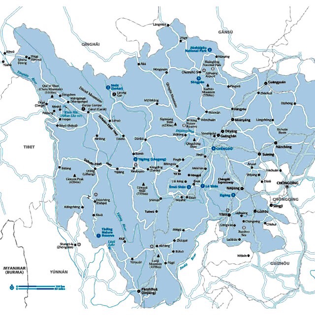
We climb and then open out onto the flat plain above Ganzi, the snow capped mountain range keeping us company to our left, the river to our right.
We remind ourselves that any miles we cover this afternoon will simply make tomorrow’s cycle up to the lake easier so we don’t push too hard.
We pass some incredible gompas (Tibetan temples) with their golden roofs and collection of prayer wheels and eight white chortens.
Much like the past few days, by 5pm dark rain clouds had started to roll in so we made finding a suitable camping spot a priority.
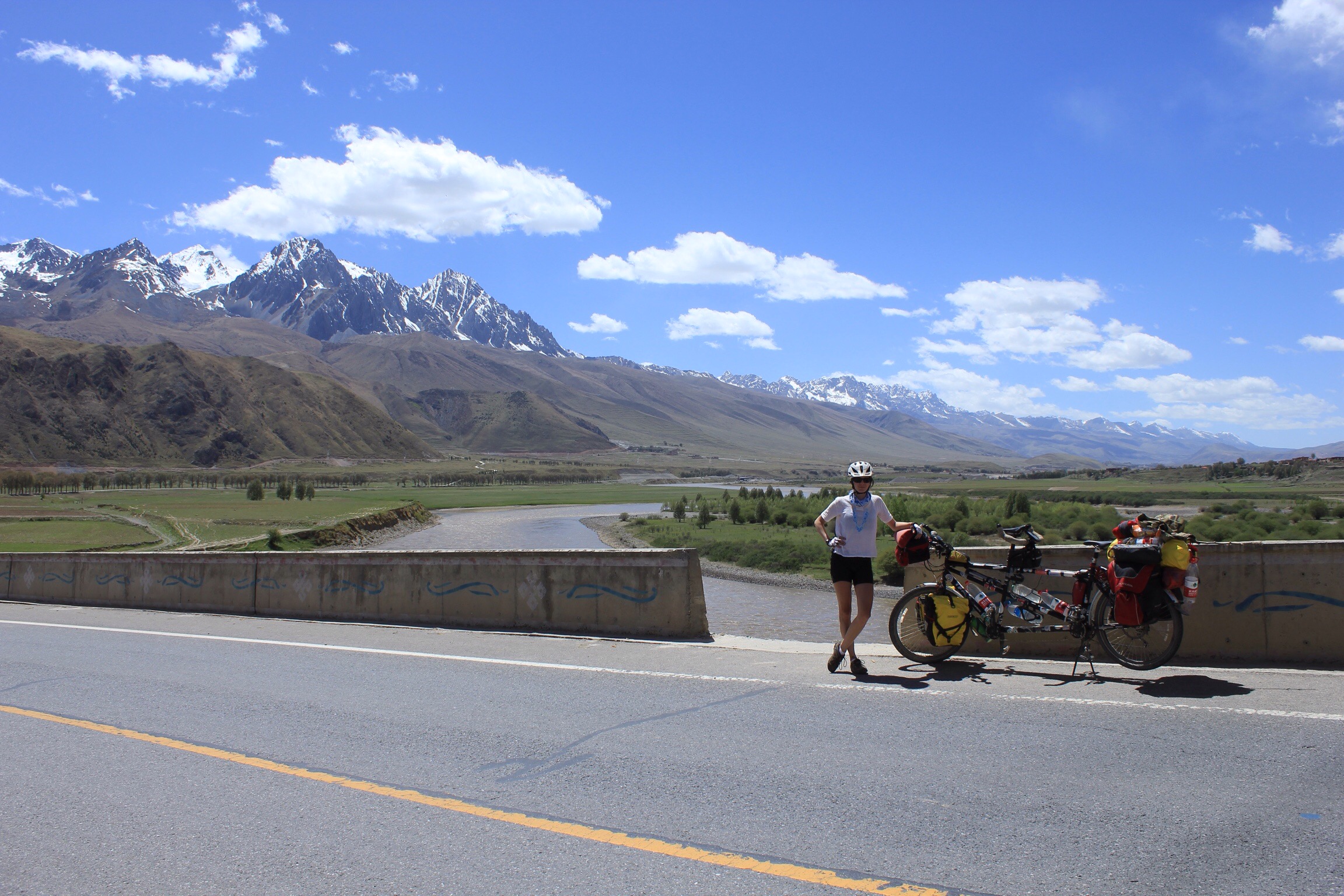
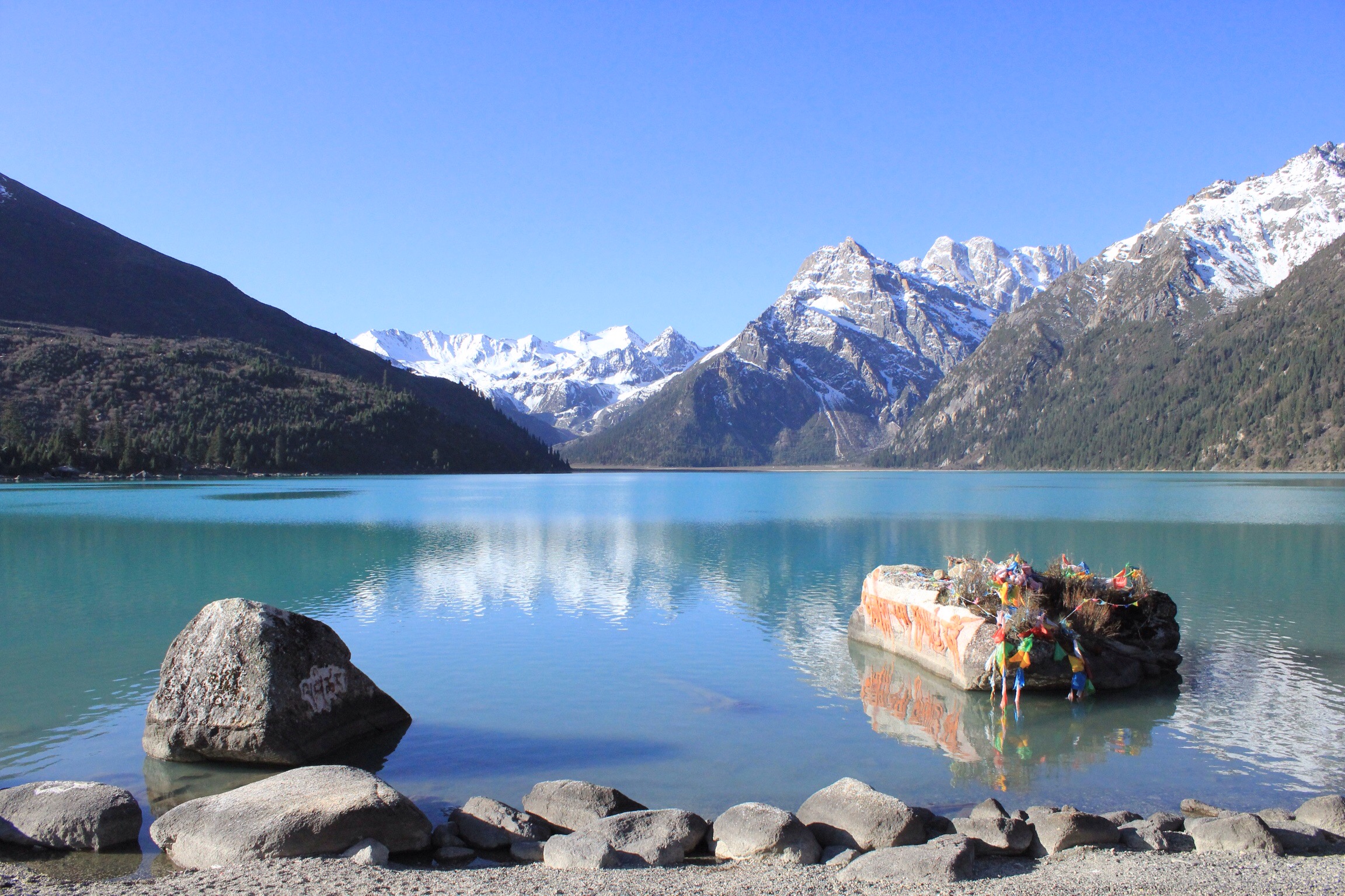
We settled on this lovely river bank. Snow capped peaks to our right and this beautiful decorated rock complete with prayer flags and bunches of colourful flowers to our left. It is obviously a holy site and we hope its ok to camp here.
 Paddy captured the mood of the sky very well in this picture.
Day 2: Pilgrims, Glacial Peaks and the Paradise Lake
Stats: 72km / 4:35 hours
The next morning we had a late start as we were both tired. I guess we hadn’t really had a rest day since Litang… We got breakfast going and finally finished packing at around 9am.
We hadn’t been going long before we were waved down by five women who were sitting on the grass having their own breakfast of homemade baba bread.
As we sat together sharing bread and oranges they explained they were on a pilgrimage, walking to Lhasa, the capital of Tibet. Each night they would stop at a monastery along the way.

After waving them goodbye and wishing them luck we carried on with our steady climb towards the town of Manigango which lies 15km away from the lake and where we planned to have a late lunch.
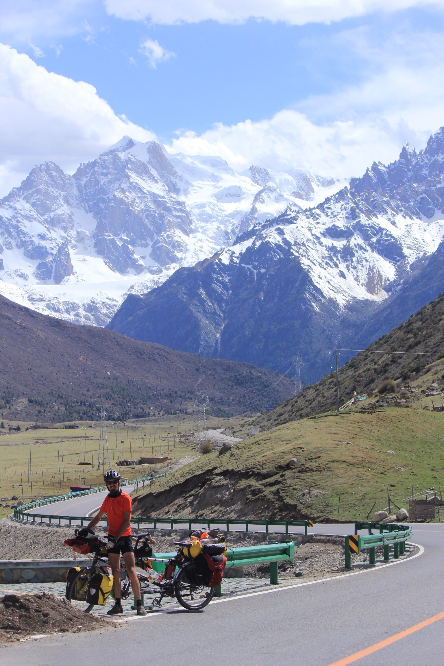
Before reaching the town, there was one final important point of interest for us on this stretch of road, and that was where we guessed we might come back out to meet this road after completing the loop.
As I mentioned before, the final stretch of the route was a slight unknown to us. Here is Paddy at a road intersection. The valley behind him is where we hope we will come through in six days time…

In Manigango we met a couple of guys from Beijing who were travelling by motorbike across China. Their bikes were beasts!

The final 13km up to the alpine lake of Yihun Lahtso took longer than we hoped but we did stop a number of times to take some photos of the very cool glacier clad peaks.
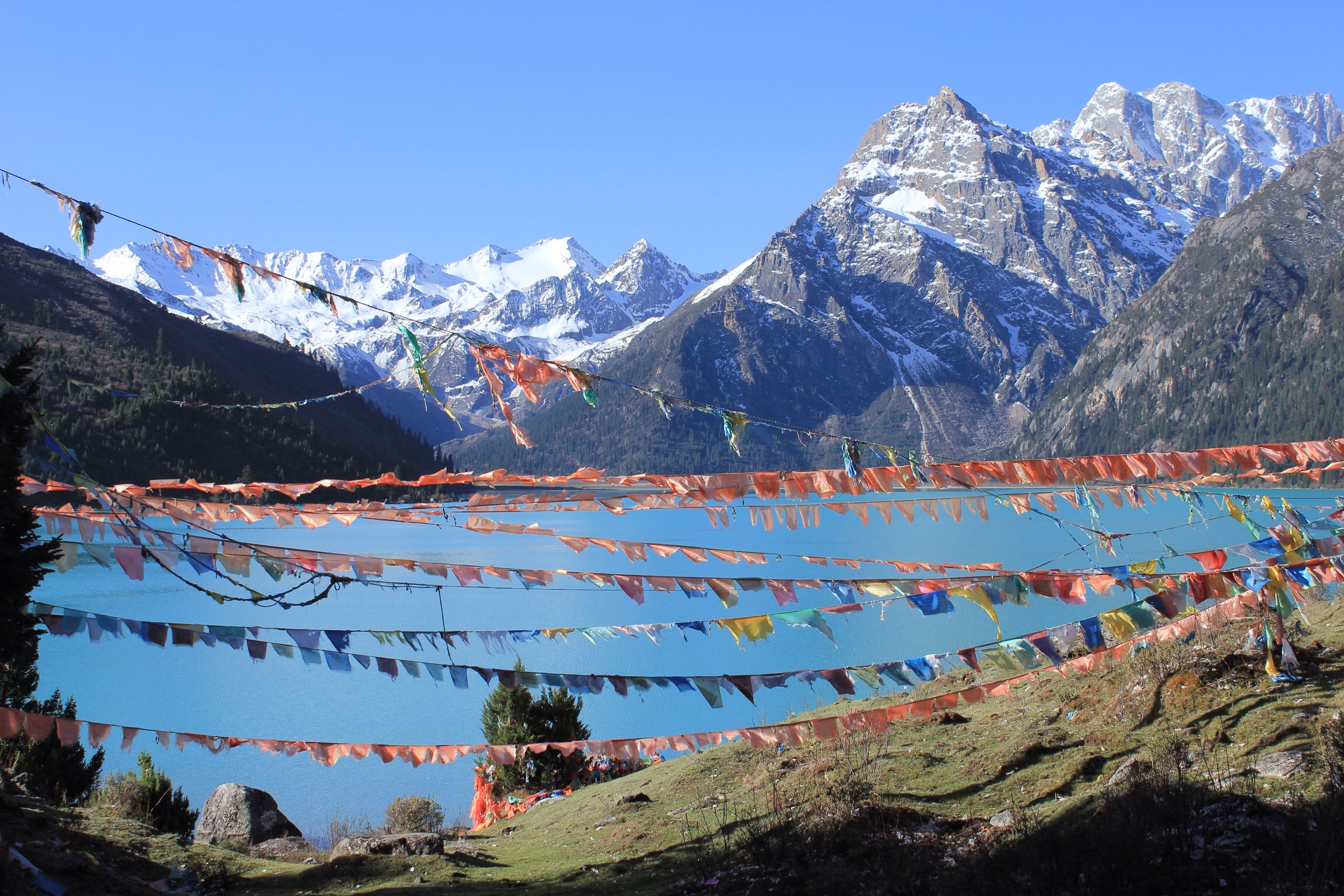
It cost us 60Y for us both to enter the lake, but boy were we glad to be camping here for the night – it is, without doubt, the most beautiful place I have ever been.
Paradise.
The last few nights it had got to 4.30/5pm and the rain storms had rolled in but not this evening…
The lake is a very holy place and the rocks around the water edge are carved with Tibetan scripture.
Across the water we see a group of red robed monks packing up their camp.
A couple of the younger monks came to say hello. One of them was keen to try on my helmet.

It was perfect, and after 6pm we had the whole place completely to ourselves.
Don’t listen to the guidebook (it says camping is frowned upon) which we find often to contain misinformation. We set up camp and cooked up one of the nicest a meals we’d had in a long time too.

We spent the evening in contented silence as we both lapped up the view. It was perfectly still and so silent.

Day 3: Chola Mountain and the long downhill to Dege.
Stats: 105km / 6:35 hours
We both slept well despite the frost! Getting up early was sublime and we lingered for a long time not wanting to leave this idyllic place.
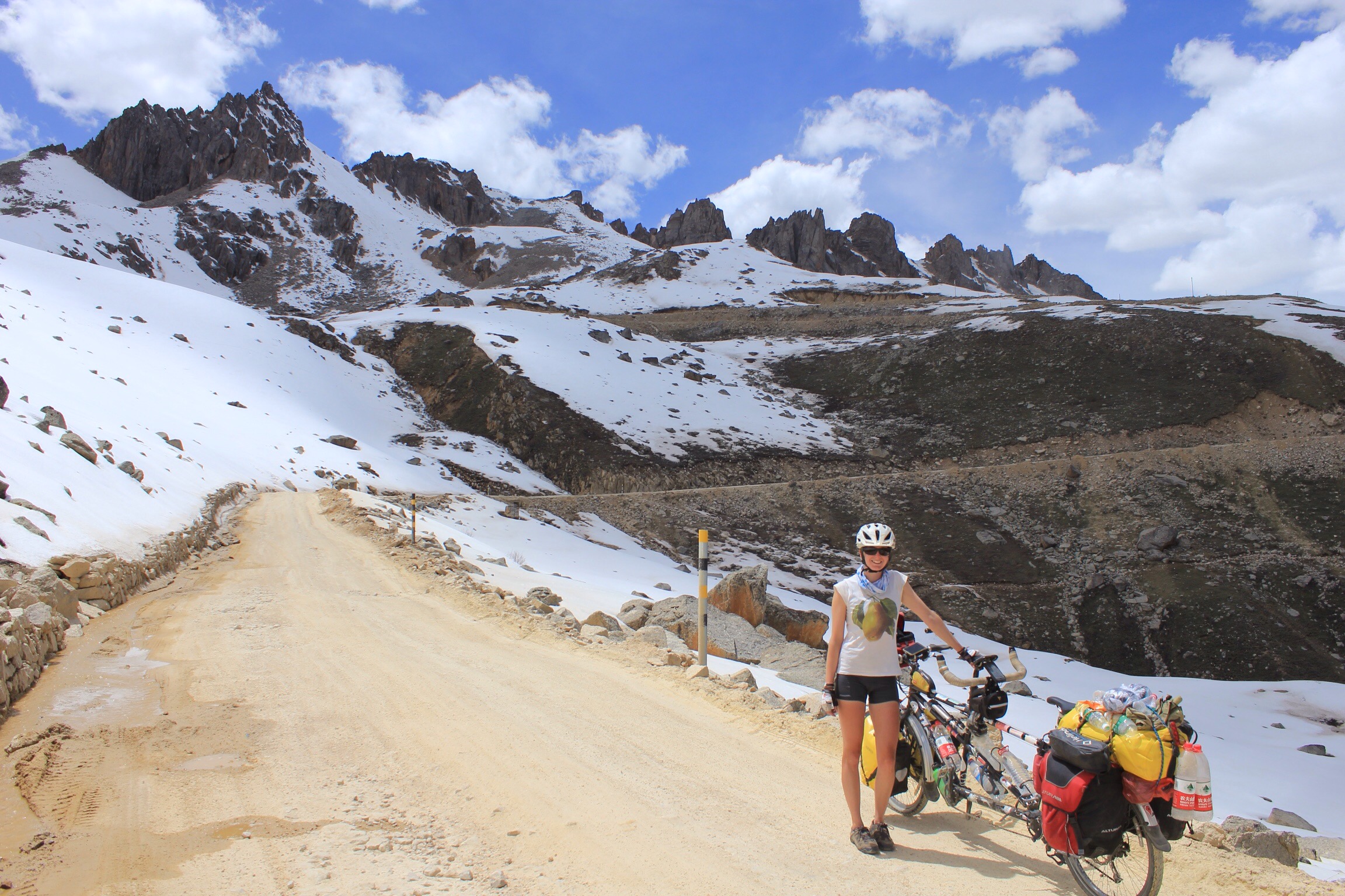
 We needed to press on though as we had the infamous Chola pass to complete today – a bumpy, dusty, busy road which would see us climb to 5050m – our highest yet!
Thankfully the road is nicely paved for a good distance after the lake. They are busy building a tunnel where the unpaved track starts and it seems that in a few years the chola pass will be blissfully truck free…
Constant upkeep by two teams, one on each side of the mountain, ensure the road doesn’t crumble away.
The climb wasn’t that bad, we’ve done worse, but the dust made parts of the cycle pretty horrible. At least the trucks when they did pass tended to do so in groups…

This meant we did get some restbite to enjoy the views!

We reach the top which is decorated with the standard collection of prayer flags and while we’re stopped we get showered in lots of colourful prayer confetti which drivers fling out the window as they pass.

The downward stretch isn’t too bad – about 70 mins – we concentrate on getting passed the trucks (we’re faster than them) and we finally get back onto paved road.
It’s 4.30pm and we’ve done well for time. We weren’t planning to get to Dege until tomorrow but a closer inspection of the map showed it was downhill 40 or so km all the way to the town.
On the way we pass by a guy who is wearing knee pads and wooden slats on his palms. Yes, he is undertaking the ultimate pilgrimage – bowing the whole way to Lhasa!
We pass through some lovely countryside including an impressive gorge and reach Dege around 7pm.
Rest day tomorrow!
